|
BACDS
Spring Fever Dance Weekend |
|
|
|
||


Location/Camp Site:
|
|
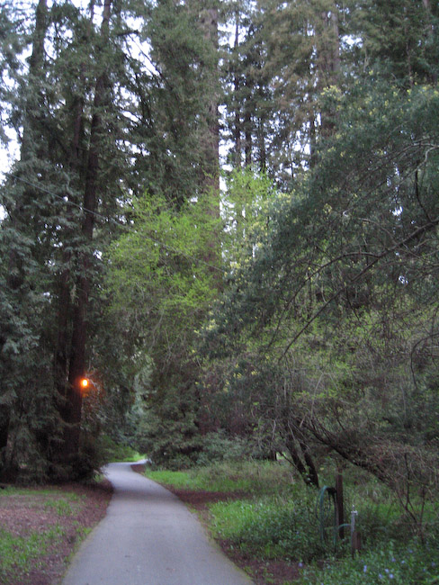
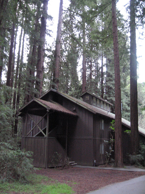
Monte Toyon (literally "mountain with the Toyon bush") Camp, located at 220 Cloister Ln, Aptos, CA, is a beautiful site nestled at the foot of the Santa Cruz mountains. It gives the idyllic impression of being remote and far away from it all, yet is less than 15 minutes from the beach, the Pacific Coast Highway, or the civilizing influence of Aptos and its modern conveniences including grocery stores, coffee shops, and espresso bars. |
|
|
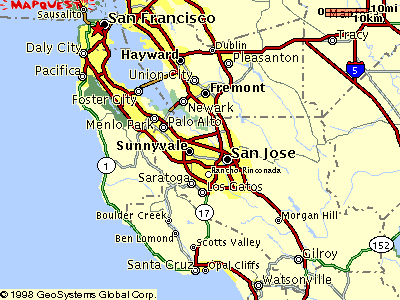
Aptos is located about 8 miles south of Santa Cruz along California Hwy 1, about one hour south of San Jose, or two hours south of San Francisco. If you're flying in from out of town, San Jose Airport is closer and preferable to San Francisco Airport. |
||
Directions:
To figure your own personal route use this full-size interactive map. However, here are a few suggested routes below as well.
 If you're
coming from the north or east, the main idea is to first get to the San Jose area. To do that:
If you're
coming from the north or east, the main idea is to first get to the San Jose area. To do that:
- From East Bay or From Sacramento - get to I-880 south (from I-80, I-580, or I-680 south)
- From San Rafael (Marin) and points north - US-101 south, cross the Richmond Bridge to I-580 south, then I-880 south
- From below San Rafael - US-101 south, cross Golden Gate Bridge, then as from San Francisco (west side)...
- From San Francisco (west side) - 19th Ave south to CA Hwy 1 south, to I-280 south, to CA Hwy 85 south to I-880/CA Hwy 17 south
- From San Francisco (east side) or from San Francisco Airport (SFO) - US-101 south to CA Hwy 85 south to CA Hwy 17 south
- From the Peninsula / South Bay - US-101 or I-280 south to CA Hwy 85 south, to CA Hwy 17 south
- From San Jose Airport (SJC) - I-880 south to CA Hwy 17 south
Once in San Jose (or heading south on I-880, which eventually becomes CA Hwy 17):
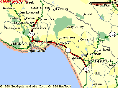
- Take Hwy 17 South towards Santa Cruz.
- Head south on the Pacific Coast Highway (CA-1) towards Watsonville/Monterey. Note: This is where traffic starts to back up.
- Take the State Park Drive (exit 435 - previously the Seacliff-Aptos exit) and turn left from the off ramp.
- Turn right at the traffic light onto Soquel Drive (note shopping center here - good place to pickup last-minute stuff).
- Continue under the railroad trestle.
- Bear left at the stop sign and continue into Aptos Village to the stop sign at Post Office Drive.
- Turn left onto Post Office Drive (formally Trout Gulch Road), crossing over the railroad tracks.
- Turn left onto Cathedral Drive at the Monte Toyon Camp sign.
- Monte Toyon is 1.5 miles along Cathedral Drive. Look for the 2nd Monte Toyon Camp sign.
If you're coming from south of Santa Cruz, you pretty much want to find CA Hwy 1 heading north. To get there:
|
 |
Send comments and questions about this webpage to the webmaster.
Revised: 03/13/2016